
The Island That Rose From the Sea
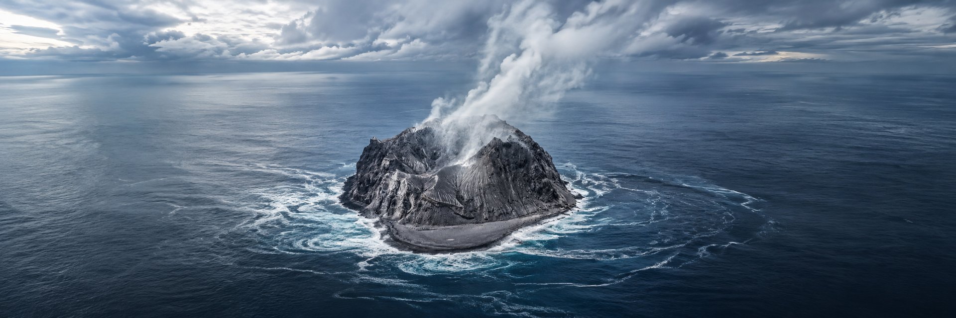
Didicas Volcano — a mountain born from fire and ocean deep in the Babuyan Channel, and one of the youngest volcanic islands in the Philippines.
FEATURED STORIES
Joseph Pasalo
6/5/20266 min read
What Is Didicas?


There are places on this earth that should not exist — islands that erupted from beneath the ocean, solidified into land, then sank back beneath the waves, only to rise again. Didicas is one of them.
|
Published just days ago, the latest installment from the Babuyan Islands documentary series takes viewers somewhere even more remote than Calayan or Camiguin: a solitary volcanic cone standing alone in the Babuyan Channel, with no permanent inhabitants, no dock, and a geological history that reads like something between a science textbook and a ghost story.
The video's title — Visiting the Island that Suddenly Rose from the Sea — does not oversell it.

__
Didicas Volcano is an active volcanic island in the province of Cagayan, sitting roughly 22 kilometers northeast of Camiguin de Babuyanes in the Luzon Strait. It is part of the Luzon Volcanic Arc — a chain of volcanoes formed by the subduction of the Philippine Sea Plate — and like every active volcano in the Philippines, it sits on the Pacific Ring of Fire.
What makes Didicas extraordinary is not simply that it is volcanic. It is that it is new. The island in its current form rose from a submarine eruption in 1952, making it one of the youngest pieces of land in the entire Philippine archipelago. Before 1952, there was no island here — only open water, and beneath it, a sleeping giant.
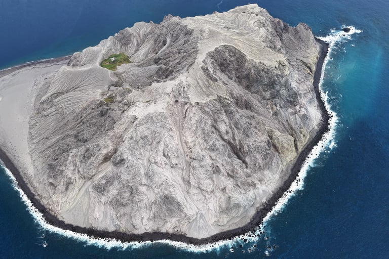
At its summit, a lava dome reaches 228 meters above sea level. Its base spans roughly 1.5 kilometers in diameter. A 400-meter-wide crater sits on its northern flank, carved during the same 1952 eruption that birthed the island itself.
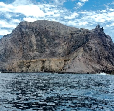
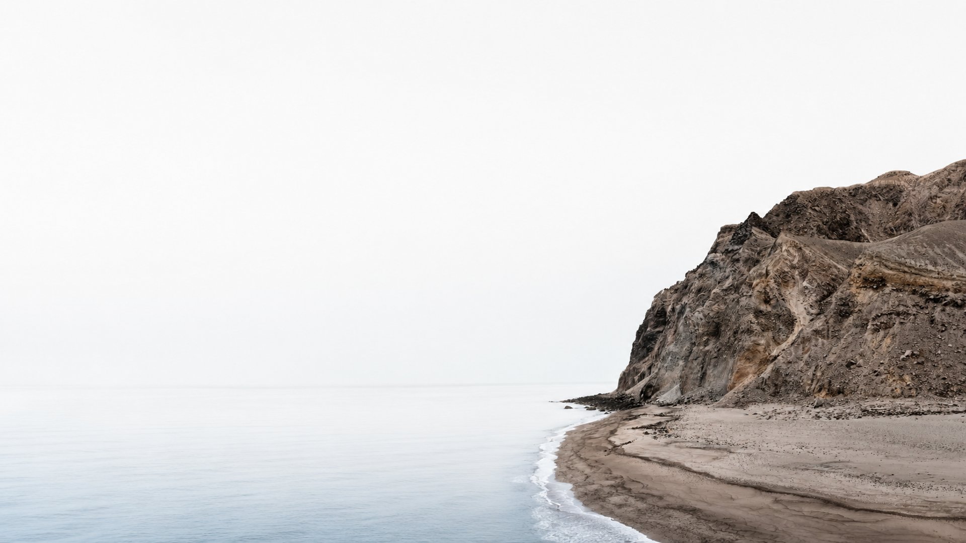
Didicas has been awakening and disappearing for centuries. Its recorded history is a sequence of eruptions that shaped — and erased — the island multiple times before the current landmass stabilized.
A History Written in Fire
__
1773. The first recorded submarine eruption, observed from what sailors then called the Didicas reefs of the Farallones. The sea itself was boiling.
1856–1857. Activity began as a column of smoke rising between two rocks well-known to local fishermen. By 1857, the volcano erupted violently, attended by earthquakes, and broke the surface of the ocean for the first time in recorded history.
1857–1860. Over four years of near-constant activity, the emerging island grew to a height of 700 feet. Then the ocean reclaimed it. Wave erosion consumed the young structure and the island sank once more beneath the surface.
1900. Another eruption left three rock masses protruding up to 82 feet above sea level — remnants of the volcano stubbornly reasserting itself against the water.
1952. The defining eruption. Beginning around March 16, explosive dome-building activity broke the ocean surface and built the island that stands today — approximately 1.5 kilometers in diameter, rising more than 228 meters above sea level. The Didicas we can visit now was born in this moment.
1969. The darkest chapter. Phreatomagmatic explosions — caused when magma meets seawater — erupted from a new crater on the northern side of the island. The resulting volcanic tsunami killed three fishermen working nearby. Air reconnaissance reported bubbling mud on the crater floor. These were the first recorded fatalities from Didicas, and they underline a truth this island insists upon: it is not tamed land. It is geology in progress.
1978. The most recent eruption on record — a relatively mild event that blanketed the island in volcanic ash. Since then, Didicas has remained dormant, monitored by the Philippine Institute of Volcanology and Seismology (PHIVOLCS) through satellite data and regional seismometers.
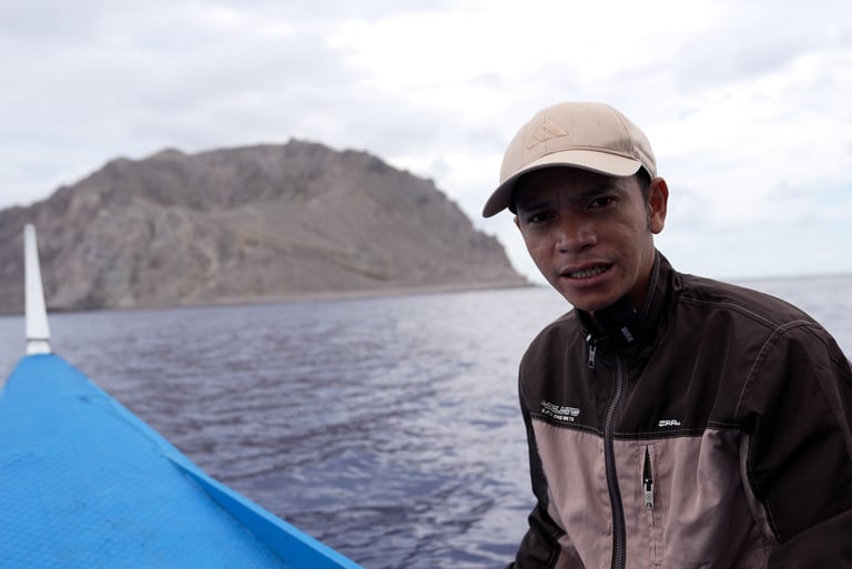
The documentary does not pretend that Didicas is easily reached. Getting here means crossing to the Babuyan Islands first — itself a multi-hour, wave-battered boat journey from the northern tip of Luzon — and then navigating additional open ocean to reach an island with no harbor, no residents, and no infrastructure of any kind.
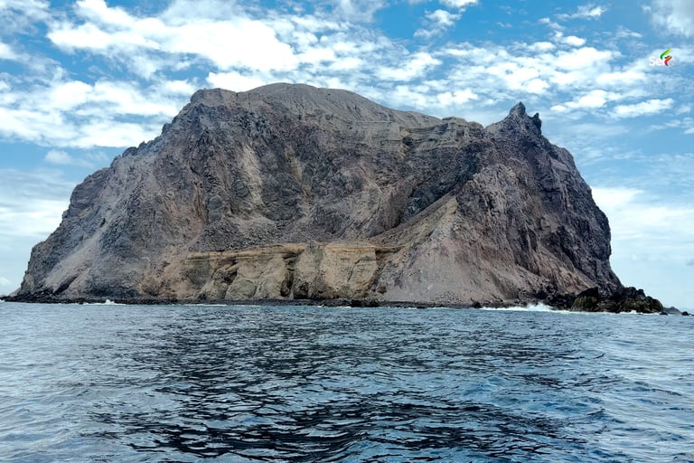
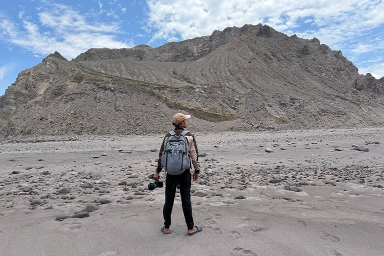
What the camera captures is the island as it actually is: a solitary volcanic cone rising from the sea with almost theatrical isolation. Sulfuric vents are visible on the upper reaches, proof that beneath the calm surface, the geology here remains alive. The approach by boat allows the full scale of the island to register — a mountain that appeared from nothing within living memory, standing alone in the Babuyan Channel as if it has always been there.
The filmmakers wisely do not attempt to land and climb. The rock faces are unstable, no trails exist, and the footing would be genuinely dangerous. Instead, the video circumnavigates the island, letting the strangeness of the place do the work. It is the right call. Didicas does not invite conquest. It invites witness.
What the Video Shows
__
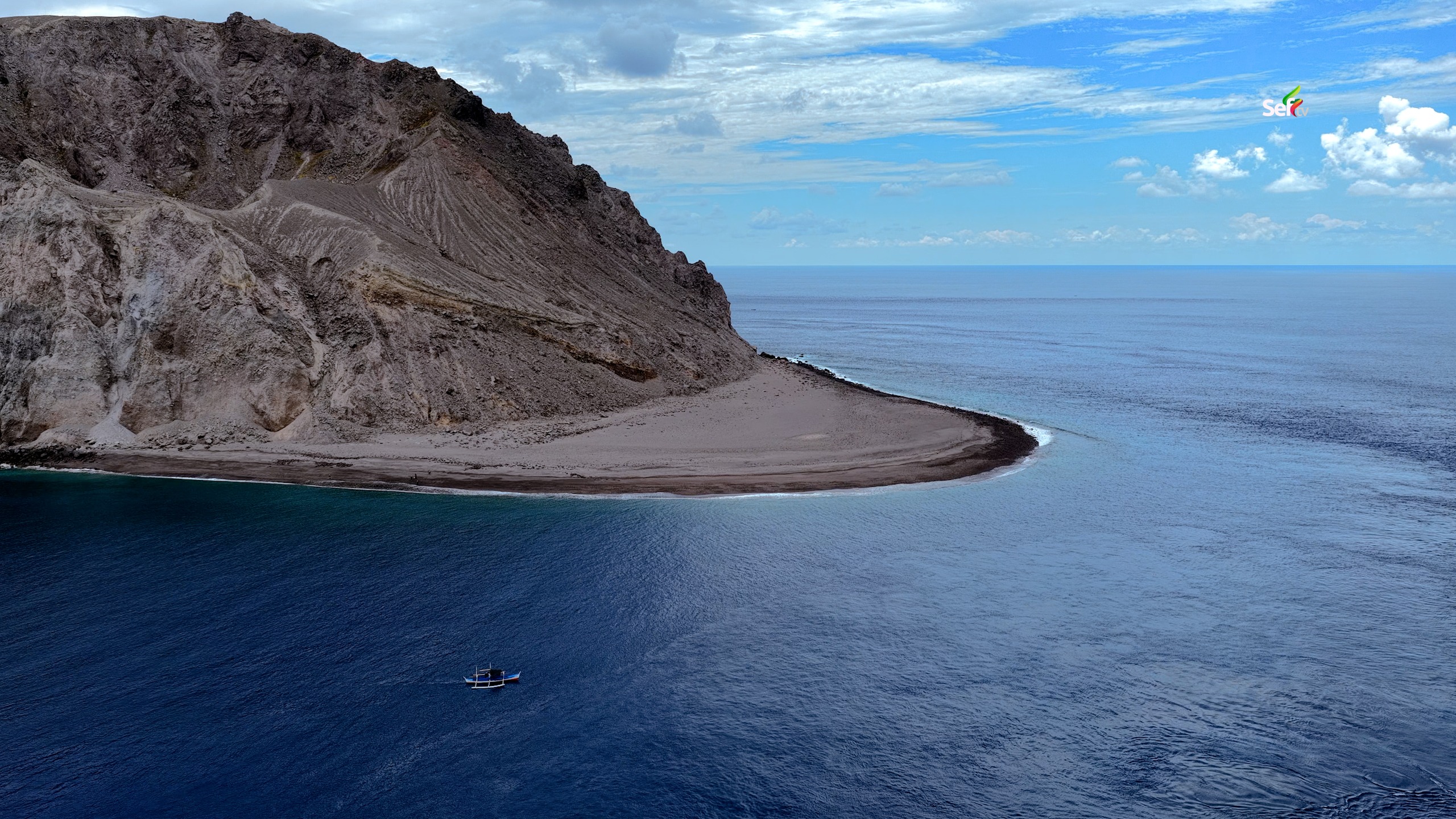
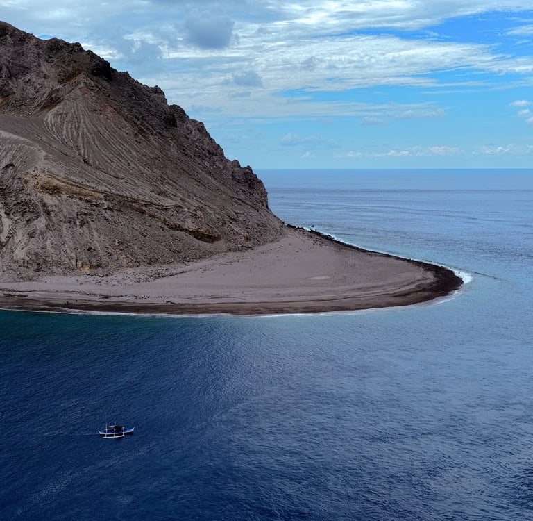
"Didicas is a mysterious volcanic island in the Babuyan Channel, rising alone in the middle of the sea like a mountain born from fire and ocean."
Geologically, Didicas is an andesitic lava dome — the same category of volcanic structure responsible for some of history's most explosive events. It sits at the northern end of the Luzon Volcanic Arc, formed by the eastward subduction of the South China Sea Basin beneath the Philippine Mobile Belt along the Manila Trench. As the oceanic plate descends, it releases volatile compounds that trigger partial melting in the mantle above, producing the intermediate magmas that fuel Didicas and its neighboring volcanoes.
The 1952 eruption was what volcanologists call explosive dome-building activity: rapid extrusion of viscous andesitic lava that piled up rather than flowing outward, creating the distinctive steep-sided cone visible today. Phreatomagmatic phases — where seawater penetrates the volcanic system and flashes instantly to steam — drove the most violent pulses of that eruption, and returned with deadly effect in 1969.
The current island is classified as active by PHIVOLCS. Despite dormancy since 1978, the potential for reactivation exists, and the remote location means any response to a future eruption would be extremely limited.
The Science of a Self-Made Island


A Ghost on the Philippine Map
The Philippines counts 7,641 islands in its official tally — but that number is not fixed. When Didicas emerged in 1952, it added to the count. Its earlier cycle of rising in 1857, growing for four years, and then being eroded back beneath the ocean before 1900 is a reminder that the Philippine archipelago is not a static geography. It is a living system, still being assembled by the same forces that created it.
Didicas is arguably the starkest proof of that. Most of the Philippine islands have been land for millions of years. Didicas has been land for barely seven decades. People who were born before 1952 were born into a world where this island did not exist.
Primary video source
Visiting the Island that Suddenly Rose from the Sea — YouTube, published June 2026. youtu.be/kV8liaaH0TY
Encyclopedic & scientific references
Wikipedia — Didicas Volcano entry, covering eruption history, coordinates, elevation, geological classification, and the 1969 fatalities. en.wikipedia.org/wiki/Didicas_Volcano
Smithsonian Global Volcanism Program — Institutional record of Didicas eruption history, crater formation details, and volcanologist field reports from the Commission on Volcanology. volcano.si.edu/volcano.cfm?vn=274020
Grokipedia — Detailed geological profile including the andesitic dome composition, Luzon Volcanic Arc subduction mechanics, and phreatomagmatic eruption characterization. grokipedia.com/page/Didicas_Volcano
Volcanology & geology sources
VolcanoLive (Dr. John Seach) — Geology and volcanology breakdown: andesitic dome classification, submarine-to-subaerial transition in 1952, 1969 tsunami event, and current PHIVOLCS monitoring status as of February 2026. volcanolive.com/didicas.html
PeakVisor — Geographic and geological summary confirming the 1857 first breach and 1952 re-emergence. peakvisor.com
Travel & expedition context
Pinoy Mountaineer (Hiking Matters #549) — First-hand expedition account of circumnavigating Didicas by boat, observing sulfuric vents, and the difficulty of approach from the Babuyan Islands.
Original Diving / Euronews — Context on how Didicas's 1952 emergence temporarily changed the Philippine island count.
Uncharted Philippines — Expedition context for the broader Babuyan Islands, describing boat crossing conditions, island-to-island travel, and ecological features.